Thursday, 12 April 2012

planing to visit panchgani

planing to visit panchgani

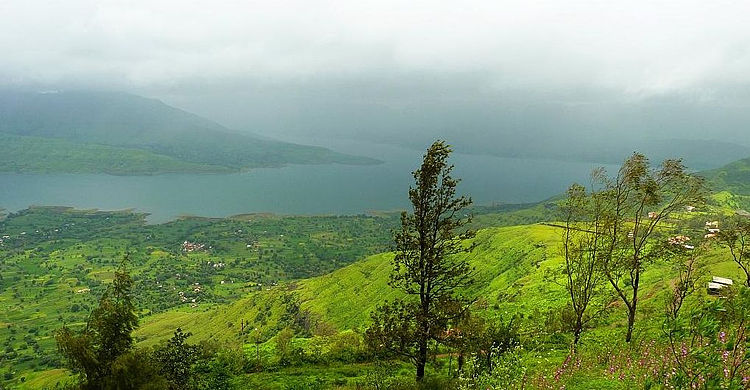
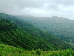
Located in the Satara District in Maharashtra, Panchgani is a well known tourist destination. The town got its name, ‘Panchgani’, as it comprises of five villages situated in the middle of five hills in the Sahyadri mountain ranges.

Panchgani is bordered by Wai, Bavdhan and Nagewadi dam in the east, Gureghar in the west, Khingar and Rajpuri in the south and Dhom Dam in the north. The town lies at an altitude of 1334 metres above sea level and due to this; the temperature is around 12⁰ Celsius during winter and 34⁰ Celsius during summer.
Panchgani was originally settled by retired Britishers, but since it was pleasant throughout the year, others also settled there. a number of attempts to start schools were made in the 19th century. In the 1890s The Kimmins School was started for European boys and girls. In 1902, the boys section separated to become The European Boys High School, now known as St. Peter's High School, And Kimmins became an exclusively girls school. Also in the 1890s, one or two years after Kimmins was started, the Roman Catholic Order of nuns known as Daughters of The Cross started The St. Joseph's Convent Girls High School. All three boarding schools were modelled on the English Public Schools of that time, and were affiliated to Cambridge University. The Board exams would be held in December, the question papers being sent from England by sea. The answer papers sent back by sea to England, and the results declared some time in June.
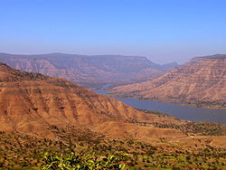
Situated on a hillock facing the Krishna Valley, Sydney Point offers an aerial view of Dhom Dam, Pandavgad and Mandhardeo. Replete with natural beauty, the town also contains table land, a flat and large expanse of laterite rock. The place is famed as the second longest mountain plateau in Asia. A short distance from table land is the Devil's Kitchen.

This cave is of mythological importance, owing to the belief that Pandavas of the Mahabharata epic had stayed here for a while. Bhim Chula, Harrisons Valley, Sydney Point, Dhom Dam, The Lingmala Falls and Rajpuri Caves are other popular attractions of the town. The town is also home to a number of historical forts like Pratapgad Fort that was built by the famous Maratha warrior Chhatrapati Shivaji in 1656.

This fort that has an elevation of 900 m was built with a purpose of checking the progress of surging rebellious rulers of the nearby Javali Basin. At an elevation of 4,522 ft opposite the Dhom backwaters lies the Kamalgad Fort. From the fort, tourists can avail beautiful views of the Krishna River and the coastal plains.

Wednesday, 11 April 2012

visit to kolhapur


visit to kolhapur

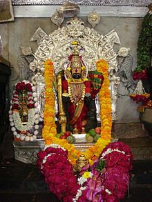
Kolhapur, the land of magnificent temples, is the religious pride of Maharashtra. Nested in the tranquil laps of the Sahyadri mountain ranges, it is situated on the banks of the river Panchganga. Also termed as a city of palaces and gardens, it is a historic Maratha city, with the Mahalakshmi temple forming the focus.
Arts, aristocracy and graciousness, combined with culture stepped in spiritualism, education and modernization.

According to Hindu mythology, Kolhapur was settled by Kolhasur, a demon who was later killed by Mahalakshmi to relieve the local populace. However, honouring the demon's dying wish, the city was named after him. Kolhapur finds mentions in Devi Gita, the final and most important chapter of the Srimad Devi Bhagawatam, as one the important places of Shakti worship, "Devi spoke:..."O King of Mountains! Still I am now telling something out of My affection to My Bhaktas. Hear. There is a great place of pilgrimage named Kolhapura in the southern country. Here the Devi Laksmi always dwells...."[3] Kolhapur was a major and popular Buddhist destination during 6th century BC

Kolhapur's climate is a blend of coastal and inland climate of Maharashtra. The temperature has a relatively narrow range between 10°C to 35°C. Summer in Kolhapur is comparatively cooler, but much more humid, compared to neighbouring inland cities. Maximum temperatures rarely exceed 38°C and typically range between 33 to 35°C. Lows during this season are around 24°C to 26°C. The city receives abundant rainfall from June to September due to its proximity to the Western Ghats. The heavy rains often lead to severe flooding in these months. Temperatures are low in the rainy season and range between 19°C to 30°C. Kolhapur experiences winter from November to February. The winter temperatures are a bit higher compared to other cities in Maharashtra such as Pune and Nasik. Lows range from 9°C to 16°C while highs are in the range of 26°C to 32°C due to its high elevation and being adjacent to the Western Ghats

The Kolhapur New Palace. Home to the living descendants of Chatrapati Shahu Maharaj. The Ground Floor has been converted into a Museum. The Museum displays furniture, weapons, clothing used during the regime and by His Highness Shri Chhatrapati Shahu Maharaj himself. It also has photographs depicting his life right from his childhood to being a young hunter to a social reformer.

Tuesday, 10 April 2012

Visit to Aurangabad

Aurangabad was founded in 1610 A.D.[citation needed] by Malik Ambar, the Prime Minister of Murtaza Nizam Shah of Ahmadnagar, on the site of a village called Khadki. He made it his capital and the men of his army raised their dwellings around it. Within a decade, Khadki grew into a populous and imposing city. Malik Ambar cherished strong love and ability for architecture. Aurangabad was Ambar's architectural achievement and creation. Malik Ambar died in 1626.[3] He was succeeded by his son Fateh Khan, who changed the name of Khadki to Fatehnagar. With the capture of Daulatabad previously known as Devagiri by the imperial troops in 1633, the Nizam Shahi dominions, including Fatehnagar, came under the possession of the Moghals.

In 1653 when Prince Aurangzeb was appointed the viceroy of the Deccan for the second time, he made Fatehnagar his capital and renamed it Aurangabad. Aurangabad is sometimes referred to as Khujista Bunyad by the Chroniclers of Aurangzeb's reign.
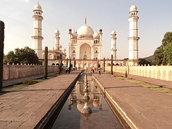
Bibi Ka Maqbara 1880s

Bibi Ka Maqbara was built in 1660 by Aurangzeb's son, Azam Shah, as a loving tribute to his mother, Dilras Bano Begam. In 1720, Nizam-ul-Mulk Asif Jah, a distinguished General of Aurangzeb with the intention of founding his own dynasty in the Deccan, arrived at Aurangabad and made it his capital. He paid a visit to Delhi in 1723, but returned in 1724, Nizam Ali Khan Asaf Jah II transferred his capital from Aurangabad to Hyderabad in 1763.[4]

Aurangabad was a part of Nizam's princely Hyderabad State until its annexation into Indian Union and thereafter a part of Hyderabad state of India until 1956. In 1956 it became a part of newly formed bilingual Bombay state and in 1960 it became a part of Maharashtra state.
[edit] 1857 War of Independence

1857 War of Independence

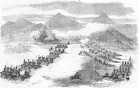
The year 1857 was eventful in the history of Aurangabad with the rest of the country. The British moved the first cavalry from Mominabad (Ambejogai) to Aurangabad to relieve 3rd cavalry which had marched to Malegaon, and was the first regiment to show signs of disaffection. The 2nd Infantry also came under suspicion. The authorities at Hyderabad were kept informed of the course of events by express. Upon this, a column of troops was ordered to march from Pune to Aurangabad. In the meanwhile, the artillery was also showing signs of rebellion, but the rumour of Bombay troops marching towards Aurangabad had a quieting effect. The men of the cavalry also returned to their posts

Monday, 9 April 2012

visit to lucknow

visit to lucknow

Dr. B.R. AMBEDKAR SAMAJIK PARIVARTAN STHAL

one of the major attraction in modern Lucknow,which spread over 107 acres of land in Gomti Nagar, which is dedicated to the memory of Dr. B.R. Ambedkar.As one passes through the gateway erected on the Gomti river, this architectural splendor beautifully unfolds itself. In the heart of this sprawling complex, stands a 112 ft. high memorial resembling a Stupa with a 18 ft. high bronze statue of Dr. Ambedkar. The various buildings such as Dr. Bhimrao Ambedkar Smarak, Samajik Parivartan Sangrahalaya, Samajik Parivartan Gallery, Pratibimb Sthal, Drishya Sthal, Gautam Buddha Sthal, Samajik Parivartan Stambh, expansive forecourt, Monumental elephant gallery, bronze fountains, Ashokan Columns & urns, entrance plazas can also be seen within this grand monument, Its lush gardens & lanes with a 20 ft. wide canal surrounding the memorial and the serene atmosphere leave the visitors spell bound. This memorial also comes alive at night when Sprawling Campus is illuminated with beautiful lighting.This enchanting sight a must see for every visitor to Lucknow.

This construction is the heart of the entire Memorial. The sanctum sanctorum consists of many statues depicting the biography of Ambedkar. There are four doors in opposite directions. This is a construction in the shape of flower with four petals.

There is a statue of Ambedkar seated in a chair, facing towards the two domes. At the bottom of the statue a message in Hindi reads:

DR.Ambedkar vihar

  The Gomti Vihar has been developed on this southern embankment of the river Gomti on an area of about 90 acres near Dr. Bhimrao Ambedkar Parivartan Sthal. The Vihar, ideal for strolling and picnicking has four adjacent huge parks.

buddha vihar

  5 km away from Charbagh Railway Station on the V.I.P. Road, the Bauddha Vihar Shanti Upvan is another new attraction of the city. The site, spread over an area of about 32.5 acres, presents a rare picture of architecture and symmetry, its magnificent building are built in sand-stone with tall pillars. The Meditation Hall, Library, International Buaddha Shodh Sansthan, four-faceted sculptures Bhikshu Niwas, Restaurant Parking and the lush green gardens are some of the major attractions here.
visit to ranikhet

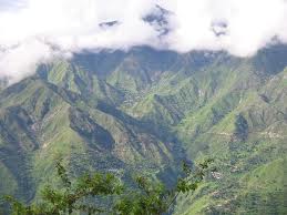
Ranikhet is located at 29.65°N 79.42°E.[4] It has an average elevation of 1,869 m (6,132 ft).The climate of the village is very cool. The cantonment is spread across two ridges, the first, called the Ranikhet ridge, is situated at an elevation of 5,983 ft (1,824 m) and the second, the Chaubattia ridge, is at an elevation of 6,942 ft (2,116 m).

Ranikhet literally means “Queen's Meadow”. It is believed that Queen Padmini of Kumaon was in love with this tiny hill paradise. Kind Sudhardev had to oblige her by building a palace here and named this place Ranikhet, the queen’s field. Though no trace of the palace can be found here today, but the place remained the same: bewitching, full of flowers, trees and green meadows in the midst of heavenly Himalayan surroundings. Lost into oblivion for long, the picturesque hill station was rediscovered by the Britishers. In 1869, the British established the headquarters of the Kumaon Regiment here and used the station as a retreat from the heat of the Indian summer. Ranikhet is a cantonment town and is the home for the Kumaon Regimental Centre & Naga Regiment and is maintained by the Indian Army. The main city of Ranikhet is fairly crowded but the military area offers serene environment.

Ranikhet becomes very cold in the winters and remains moderate in summers, and is best enjoyed from March to October. Ranikhet gets snowfall in the winter season, mainly in the months of December, January and February. But in the rest of the months the weather of Ranikhet remains pleasant.

The pine, oak, and deodar forests host an array of wildlife including leopard, leopard cat, mountain goat, barking deer, sambar, pine marten, Indian hare, red-faced monkey, jackal, langur, red fox, and porcupine

Jhula-Devi Temple

Jhula-Devi Temple is an 8th century goddess Durga temple which lies quiet close to Ranikhet Hill Station. It is believed that anybody who wishes for something in front of goddess Durga, his/her wishes are fulfilled. Lying close to Jhula-Devi Temple is temple dedicated to Lord Rama.

Thursday, 5 April 2012

visit to silchar

Silchar is the second largest city in the state of Assam and is located 420 km south-east of Guwahati. It is a popular commercial centre of Assam due to its tea farming. It is situated on the banks of the Barak River and is popularly known as Barak Valley.

Silchar is well connected by road, rail and air to the rest of the country. It is connected by a meter gauge rail network to Lumding and Agartala which is currently being upgraded to broad gauge lines. The railway station is in Tarapur, Silchar. Regular bus services connect it with Guwahati, Shillong, Aizawl, Agartala and other places.

Silchar is the economic gateway to states like Manipur and Mizoram, and the headquarters of the Cachar District. The town sees a large settlement of traders from distant parts of India every year. The place has also earned the title of an “island of peace” from the former Prime Minister of India, Indira Gandhi.

The British tea planters revived the game of polo in India in the 1850s in Manipur on the Burmese border. In fact, the first polo club of the world was formed in Silchar and the first competitive modern polo was held here. The commemorative inscription for this achievement can still be seen on the backside of the District Library, Silchar.

Silchar saw one of the uprisings in favour of the Bengali language. When the Assam government, under Chief Minister Bimala Prasad Chaliha, passed a circular to make Assamese mandatory, Bengalis of Barak Valley protested. On 19 May 1961, when Assam police opened fire on unarmed protesters at Silchar Railway Station, 11 agitators died. After the popular revolt, the Assam government had to withdraw the circular and Bengali was ultimately given official status in the three districts of Barak Valley.

Agriculture is the main occupation of Silchar and it is a processing centre of tea, rice and other agricultural products. The residents of Silchar are mostly Sylhetis and the other ones include Marwaris, Bishnupriya Manipuris, Manipuri Meiteis and the tribal group of Nagas. The culture of the city is brought out in prominent occasions like Durga Puja and Gandhi Mela.

For to get travel packages For more information on Cheap Air Tickets ( Domestic Flights and International Flight ) , Bus Booking , tour packages, rail tickets , hotels booking please check on via .com

Wednesday, 4 April 2012

visit to chamundi hills

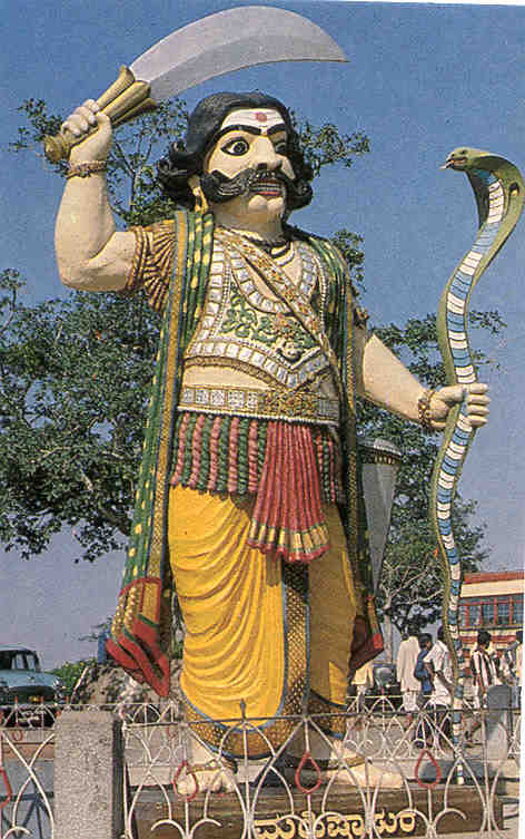
Chamundi Hills can be viewed from a distance of about 8 to 10 kms and from all the corners of Mysore City. Chamundeshwari temple is situated on the top of Chamundi hill which is about 3,489 ft. above sea level and located at a distance of 13 kms. from Mysore. The temple is dedicated to Sri Chamundeshwari, the titular deity of the Mysore Royal Family also described as ‘Mahishasura Mardini’ for having killed the buffalo headed demon Mahishasura. The temple has a very beautiful idol of the goddess wearing a garland of skulls. Goddess Chamundeshwari, also spelled Chamundeswari is an incarnation of Goddess Durga, Goddess Kali is also referred to as the Goddess Chamundi.

A flight of one thousand steps built by the Maharaja Dodda Devaraja in 1659 also leads up to the summit of the hill which is at a height of about 3000 feet. Chamraja Wodeyar IV is said to have worshipped here in 1573 and was miraculously saved from a lightning hit. Krishnaraja III (late 18th century) built the temple tower and presented the Nakshatramalika jewel with sanskrit verses inscribed on it.

Mysore was ruled by the demon-king Mahishasura, he was a buffalo-headed monster. Hence, came the name of this place - Mahishuru, the city of demon Mahisha. Hearing to the prayers of Gods and Goddess to save them from the monster, Goddess Parvathi, (consort of Lord Siva), took birth as Chamundeshwari and killed the monster. After killing the demon, the Goddess resided atop the Chamundi Hills where she is worshiped with reverence and devotion. The goddess is also known as Mahishasura Mardini meaning She who slew Mahishasura.

Thus much of the current temple is the result of renovation efforts carried out in early nineteenth century, although the original shrine is much older. Chamundi Hill has been associated with the Hoysala ruler Vishnu Vardhana (12th century) and with the Vijayanagar rulers of the 17th century.

Nandi Bull at Chamundi HillsThe Chamundi temple has always been patronised by the rulers of Mysore. In 1659 Dodda Devaraja Wodeyar built 1,000 steps and huge Nandi, Lord Shiva's Bull. This colossal Nandi is one of the largest in India, 16 ft. (4.8 meters) tall at the front and 25 ft. (7.5 meters) in length. The magnificent pendent bells around its neck are exquisite. Nandi and the temple beside it are located at the 700th step of the Chamundi Hill. Krishnaraja Wodeyar III repaired the shrine in 1827 and built the present beautiful forty-meter, seven storied Gopura (tower at the entrance) with gold finials, and set up statues of his and his three queens. In 1827, Krishnaraja Wodeyar III made arrangements for festivals and processions and gifted Simhavahana in 1843.`
For to get travel packages For more information on Cheap Air Tickets ( Domestic Flights and International Flight ) , Bus Booking , tour packages, rail tickets , hotels booking please check on via .com